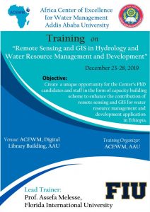
Remote Sensing and GIS in Hydrology and Water Resource Management and Development

Date: December 23-28, 2019
Location: African Center of Excellence for Water Management, Addis Ababa University
Time: Monday-Saturday: 9:00AM-5:00PM
Instructor: Assefa M. Melesse
E-mail: melessea@fiu.edu
COURSE DESCRIPTION: The course will acquaint students with the application of remote sensing principles and geospatial analysis to water resources. Remote sensing based analysis as well as vector and raster GIS will be used to analyze and model watershed processes. Various concepts of remote sensing techniques, sensors and platforms, electromagnetic spectrums, sensors and atmospheric interactions, image noises, image pre and post processing, atmospheric and radiometric corrections, image enhancement, image classification, interpretation, land-cover change detection and accuracy assessment as applied to water resources management and natural resources mapping and analysis will be covered. Grid-based input data preparation, watershed delineation, flow analysis, routing, overland and channel flow estimation and hydrograph development will be covered. Modeling water quality in a GIS environment will be covered. The use of GIS and remote sensing in spatially distributed watershed analysis, mapping and modeling will be presented using lectures, exercises and individual project.
COURSE OBJECTIVES: The primary aim of this summer school based training is to create a unique opportunity for the Center’s PhD candidates and staff in the form of capacity building scheme to enhance the contribution of remote sensing and GIS for water resource management and development application in Ethiopia. More specifically, this training is important to promote the use of remote sensing and GIS technologies and applications in order to:
- Understand remote sensing and GIS concepts and principles for water resource management and development programme in Ethiopia;
- Perform radiometric and geometric image correction to classify images, generate information and perform classification validation analysis;
- Apply remote sensing and GIS technologies to understand components of the different hydrologic cycle such as precipitation, basin/watershed/catchment characterization, evapotranspiration, soil moisture, surface water, soil erosion, water quality and quantity analysis;
- Acquire spatial data and create hydrologic input parameters from remotely-sensed data for hydrologic modeling;
- Understand modeling protocols in geospatial hydrology;
- Understand and use geospatial statistics in watershed analysis; and analyze spatial flow and learn runoff routing techniques
Benefits and Broader Impact of the Training
This training will increase and improve Ethiopian experts and researcher’s capability in the area of remote seining and GIS application for water resource management and development programme.
Training Organizer
African Center of Excellence for Water Management, Addis Ababa University
Lead Trainer:
Assefa Melesse, Florida International University
Contents of the Training:
The following contents shall be covered during the training.
Contents of the Training:
The following contents shall be covered during the training.

